City hall nearby Barangay 530
Philippines
City hall nearby Barangay 530
Barangay 530
Josefina, Sampaloc, Manila Philippines
contacts phone
:
+63
Latitude:
14.615652
, Longitude:
121.001181
read more
nearest City hall
564 m
Barangay Doña. Josefa Daza Hall
Kitanlad, Lungsod Quezon
City hall
read more
1.217 km
Barangay Hall 422
Prudencio, 422, Maynila
City hall
read more
1.469 km
Barangay Hall
Zone 42, Extremadura Street, Sampaloc, Maynila
City hall
read more
1.774 km
Barangay 468 Zone-46 Dist.4
996 Padre Campa Street, 468 Zone 46, Sampaloc Manila
City hall
read more
2.61 km
Old San Juan City Hall
San Juan, Manila
City hall
read more
2.738 km
Barangay Hall Brgy. San Jose
14 Tendido, La Loma, Lungsod Quezon
City hall
read more
2.759 km
Barangay 600 Hall
Valenzuela Extension, Santa Mesa, Manila
City hall
read more
2.781 km
Barangay Kristong Hari Barangay Hall
Unnamed Road, New Manila, Lungsod Quezon
City hall
read more
2.837 km
Barangay Hall
Kipuja Street, Santa Cruz, Manila
City hall
read more
2.878 km
Brgy Manresa
1 Makaturing, Lungsod Quezon
City hall
read more
3.022 km
Masambong Barangay Hall
Capoas, Quezon City
City hall
read more
3.19 km
Barangay Paraiso Hall
150 Roosevelt Avenue, San Francisco del Monte, Quezon City
City hall
read more
3.295 km
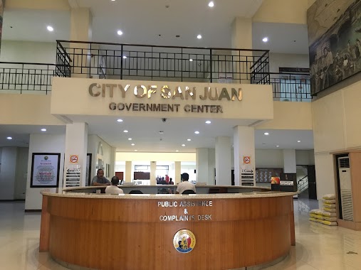
San Juan City Hall
Pinaglabanan, San Juan
City hall
read more
3.426 km
Brgy. Isabelita Hall
Pinaglabanan, San Juan
City hall
read more
3.575 km
Manila City Hall
Padre Burgos Avenue, Ermita, Manila
City hall
read more
3.597 km
Manila City Hall
369 Antonio Villegas Street, Ermita, Manila
City hall
read more
3.639 km
Daang Bakal Barangay Hall
San Juan
City hall
read more
3.649 km
Kabayanan Barangay Hall
San Juan
City hall
read more
4.008 km
Mabini - J. Rizal Multi-Purpose Hall
J.P. Rizal, Mandaluyong
City hall
read more
4.145 km
Bagong Silang Baranggay Hall
Mandaluyong City
City hall
read more
4.698 km
Barangay San Jose Multi Purpose Hall
337 Senator Neptali A. Gonzales Street, Mandaluyong
City hall
read more
5.414 km
Libra Brotherhood Multi-purpose Cooperative
412-A Compound Samson Road, Caloocan
City hall
read more
5.414 km
Libra Brotherhood Multi-purpose Cooperative
412-A Pnr ompound Samson Road, Caloocan
City hall
read more
5.423 km
Pleasant Hills Barangay Hall
Correctional Road, Pleasant Hills, Mandaluyong
City hall
read more
5.483 km
Public Information Officer Department @ Mandaluyong City
PNP Building City Government Complex, Maysilo Circle, Barangay Plainview, Mandaluyong City
City hall
read more
📑
all categories
Accounting
Administrative area level 1
Administrative area level 2
Airport
Amusement park
Aquarium
Art gallery
Atm
Bakery
Bank
Bar
Beauty salon
Bicycle store
Book store
Bowling alley
Bus station
Cafe
Campground
Car dealer
Car rental
Car repair
Car wash
Casino
Cemetery
Church
City hall
Clothing store
Colloquial area
Convenience store
Courthouse
Dentist
Department store
Doctor
Electrician
Electronics store
Embassy
Finance
Fire station
Florist
Food
Funeral home
Furniture store
Gas station
General contractor
Grocery or supermarket
Gym
Hair care
Hardware store
Health
Hindu Temple
Home goods store
Hospital
Insurance agency
Intersection
Jewelry store
Laundry
Lawyer
Library
Light rail station
Liquor store
Local government office
Locality
Locksmith
Lodging
Meal delivery
Meal takeaway
Mosque
Movie rental
Movie theater
Moving company
Museum
Natural feature
Neighborhood
Night club
Painter
Park
Parking
Pet store
Pharmacy
Physiotherapist
Place of worship
Plumber
Point of interest
Police
Political
Post office
Premise
Real estate agency
Restaurant
Roofing contractor
Route
Rv park, camping
School
Shoe store
Shopping mall
Spa
Stadium
Storage
Store
Sublocality
Subpremise
Subway station
Supermarket
Synagogue
Taxi stand
Train station
Transit station
Travel agency
University
Veterinary care
Zoo
administrative area level 3
administrative area level 5
sublocality level 1
↑